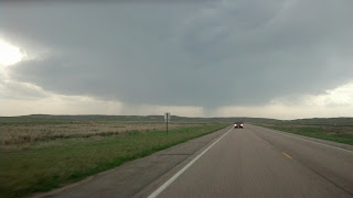
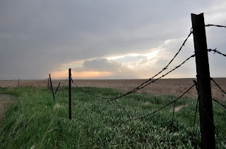
Friday, May 31, 2013

Day #12 (Volunteer and non-chase day): May 31, 2013
Starting point: Norman, Oklahoma
Ending point: Lincoln, Nebraska
Mileage traveled: 496 (Trip total: 5782)

We started our day off by volunteering in the Moore, Oklahoma area. We spent 3 hours cleaning debris out of a home owners hay field right outside the densely populated area of Moore. The tornado initiated a short distance from the property we helped clean up. Despite being near the beginning of the tornado there was still a large amount of debris in the field. The hay was ready to be baled and so the debris needed to be cleaned up so that process could begin. After volunteering we drove by the National Weather Center which houses research facilities for the National Severe Storms Lab, The Storm Prediction Center, and the Norman, Oklahoma National Weather Service office. We also briefly visited the University of Oklahoma's campus.

We did get north of the city before the storms started. We choose not to chase because we needed to start back towards home and chasing in urban areas is extremely dangerous. Given the destruction that has been shown on media outlets we are glad we made this decision; yes it would have been interesting to watch these storms develop but given the traffic problems that occurred in and around the city we could have potentially placed ourselves in some extreme danger. Something we wanted to avoid. Overall, it has been a very successful trip with today being only the second non-chase day for us out of 12. We have seen a lot of storms of various types and did get to see a quick spin up of a tornado in Texas.

Over the next few weeks we will be compiling more information about the storms we witnessed on the trip. These will come in recaps of the storms where we will be able to show weather maps, radar imagery, etc. along with the photos we captured. This blog will also be part of the information source for our new student group on campus called the UWW WeatherHawks. Some of the activities we have planned are bringing in guest speakers to campus and visiting local schools to talk about weather and climate related topics. There has already been some discussion from today's events to try to plan some kind of relief effort for the Oklahoma City area. When plans are finalized we will pass them along.


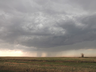
Just to let everyone know we are already on our way home. We are currently north of Wichita Kansas. Our thoughts go out to the Oklahoma City area right now as there are reports of multiple large tornadoes in and around the region.
So here was the surprise...I arranged to spend a few hours this morning volunteering in Moore, Oklahoma. We spent the time helping with cleanup of a a couple's hay field. The hay is ready to bale and the debris needed to be cleared so the owners did not loss the crop. It was an amazing experience and we all got a lot out of it. We found everything from very large pieces of siding and particle board to as small as checks, a marriage liscense, and wallet size pictures. 


Thursday, May 30, 2013

Day #11 (Chase day): May 30, 2013
Starting point: Shamrock, Texas
Ending point: Norman, Oklahoma
Mileage traveled: 417 (Trip Total: 5288)

We set out in the morning from Shamrock towards our target area of Oklahoma City. Arriving in Oklahoma City we decided to head south because of the greater cape values and upper-atmosphere support for storms. To get to our target area we drove through Moore seeing the damage of the tornado the hit the area a little over a week ago. Arriving in Purcell we headed west to intercept a thunderstorm. Approximately 18 miles outside Purcell we saw multiple areas of rotation in the storm. As we tracked the storm east towards the Purcell area a possible tornado was seen, but touchdown could not be confirmed. After the storm got east of Purcell it started to strengthen and possibly developed another tornado. Rotation was seen in the clouds, but the storm was being rain wrapped. After this storm began to weaken we decided to head back to Purcell to wait for another storm pass by so to the south so we could safely view it. Tracking resumed heading towards Pauls Valley, Oklahoma. We ended up south of Davis on the edge of the core however the rotation indicated by radar quickly weakened as we reached the storm. Moving back north to Oklahoma City more cells began to develop and quickly intensified. These storms also showed some rotation and we watched a couple of wall clouds develop. We stopped and watch the storm for approximately 10 minutes until the southern side of it began to intensify. We drove a few move miles south to get out of the path and continued to watch rotation in the storm. After the storm was east of Interstate 35 we headed towards our final destination of Norman, Oklahoma. Overall, this was an awesome day for chasing with a lot of action.

We apologize there are no pictures with this post. We probably have over 3000 pictures from the storms we saw today. However, Dr. John Frye and Ms. Alisa Hass (the ones leading the trip) have a surprise planned for the team on Friday morning. We are going to be up and on the road by 8 am; one of our earliest days of the trip so far. We also may be chasing storms tomorrow afternoon as we start heading back towards Whitewater for a Saturday arrival.

NOTE: This is Dr. Frye, yes I am keeping you followers in suspense too. I will make sure I post pictures tomorrow evening of the surprise we have in store. Those of you back home that helped set it up please no comments revealing it.
Chase Day #11: We are heading towards the Oklahoma City area today. Along the way we will decide whether to go north or south of town. Right now, we are leaning towards north.

We ask a favor for everyone who has been following the blog on a regular basis; especially school teachers. Please send us a message and let us know what school you are from and what grades you teach. You can email us at uww.weatherhawks@gmail.com.

Thank you.

Wednesday, May 29, 2013

Day#10 (Chase day): May 29, 2013
Starting point: Amarillo, Texas
Ending point: Shamrock, Texas
Mileage Traveled: 182 (Trip Total: 4871)

The target area for the day was Shamrock, Texas. We chose this area because conditions looked to be good for the development of storms. However there was no cap in place so the storms began to develop earlier then expected. We then made our way to Childress, Texas where storms began to develop. To get get a better vanage point we dropped to the south. As the storms progressed we made our way to the north where we stayed and watched the storms pass.  After the storms passed we began to head north. On our way north we saw hail in the fields and stopped to check the size of the hail, which was golf ball sized.  We finally made our way to Shamrock, Texas where we chose to stay for the night.

Day #9 (Chase day): May 28, 2013
Starting point: Hutchinson, Kansas
Ending point: Amarillo, Texas
Mileage Traveled: 538 (Trip Total: 4689)

We started our day in Hutchinson, Kansas. There was a very large area that was under the threat of severe weather; our forecast was to head towards the Woodward, Oklahoma area. This area was selected because there was a good amount of shear along with high CAPE values in this area. CAPE is the amount of instability in the atmosphere.  There was a jet streak (fast upper level winds) that was located in this area with short wave troughs extending into this area.  A dry line was also located to the west and heading to the east. All of these ingredients set up for the formation of supercell activity.

On our drive out to Woodward we drove through Greenberg, Kansas to look at the progress that the city has made since a devastating EF5 tornado in 2007. The city had rebuilt into a green city, with wind turbines, solar panels, and new green building. In addition to the green rebuilding efforts, the city has been using green landscaping techniques to utilize reduced water consumption.

While eating lunch in Woodward, we noticed a couple cells developing to the west and northwest of town. These cells were heading on a north-northeast path and continued to build on the back side of the line of storms. We chased these cells toward Beaver, Oklahoma, as we watched the storm we could tell it was rotating and there was a tornado warning issued for this storm. As we approached the storm we saw a wall cloud that was starting to form. A wall cloud is a lowering that occurs under the thunderstorm due to the storm's rotation. This storm began to fall apart as it moved off to the northwest. We then decided to drop to the south and chase another line of supercells that began to develop. The supercells were off the the southwest of Amarillo, Texas. As we got closer to the storms we began to lose daylight, and our chasing was done for the day.

We decided to stay in Amarillo to set us up for a the next day. We were still keeping an eye on the storm that was out to the west of Amarillo. The storm was strengthening as it moved toward the city, the storm was moving slow only at about 15 mph and as it started to approach the city its speed increased to 25 to 30 mph.  We decided it was best for us to drop to the south to get a better view of the storm.  We watch the storm pass through the Amarillo area, and when the storm was all clear we headed back to our hotel for the night.

Due to the late night we had we are hanging out in Amarillo until around noon and then we will move towards the Shamrock, Texas area to wait for the storms to develop.

Picture below by Andy Courtney of one of the storms near Beaver, Oklahoma.

We will start this post by saying that we are all safe. We had stopped for the night in Amarillo. After checking into our hotel and getting dinner a storm that had been west of Amarillo started to circulate and head right towards us. We loaded the vehicles back up and went to the south to wait the storm out. The storm did produce a lot of hail and there was a report of a tornado on the ground in Amarillo. We stayed safely to the south because we did not want to get in a situation at night and in an urban area where a tornado could have tracked right towards us. A full report of our day will come at some point Wednesday.

Tuesday, May 28, 2013

Day #8 (chase day): May 27, 2013
Starting Point: Hays, Kansas
Ending Point: Hutchinson, Kansas
Mileage Traveled: 404 (Trip Total: 4151)

NOTE: We have had some issues getting videos prepped for posting. Once we return we will put together videos of the storms we have been tracking. Until then enjoy the still shots we have been posting.

Today we got a late start to the day because we drove late into night to put ourselves in our target area for today. The forecast indicated there was a lot of instability and the area looked good for severe weather and tornado production. We left our hotel and hung out around south of Hays, Kansas near the frontal triple point. The frontal triple point is where three types of fronts all meet. This placed us in a good point for supercell development. We noticed clouds developing to the the southwest so we drove north hoping we let it pass in front of us. That storm was not intensifying so we decided to catch up to some additional storms to the north. We went up to Jewell, Kansas where we witnessed a funnel cloud (as of yet there were no tornado reports issued). We watched lightning as the sun set and the storms moved away from us.

We stopped last night in Hutchinson, Kansas and will be heading towards Woodward, Oklahoma for today's storms. Below are pictures of the team hanging out waiting for storms and the funnel cloud we spotted.


Monday, May 27, 2013

Chase day #7

Day #7 (chase day): May 26, 2013
Starting Point: Laramie, Wyoming 
Ending Point: Hays, Kansas 
Mileage Traveled: 661 (Trip Total: 3747)

NOTE: Sorry for the delay in posting yesterdays recap. We did not get to our hotel until after 2 am. We set ourselves up good for a chase on Monday, May 27. We will be hanging out in Hays, Kansas for now monitoring the situation to determine if we need to move.

Today we headed east towards North Platte, Nebraska area because it had a large amount of CAPE and vorticity (spinning motion in the atmosphere) which is key to strong supercell thunderstorms capable of producing tornadoes. Once arriving in North Platte, we decided to drive about 30 minutes south where we waited for the cap (e.g., negative buoyancy which prevents warm, moist from the surface to rise) to break and thunderstorms start to develop. The cap finally broke as the dry line moved into the area. The dry line is a boundary between moist air to the east and dry air to the west; the clash of these different types of air creates additional rising motion which today was instrumental to breaking the cap. The original storm proceeded to gain strength and another large supercell developed to the north west of the cell that we were chasing. As we came up on the back side of the storm near Arcadia, Nebraska we ran into many other spotters trying to capture video and pictures of the storm. Multiple times we pulled over at safe locations to get out of the car and took pictures from a safe distance off of the road. Not long after, rotation was indicated on the radar and a tornado warning was issued by the National Weather Service. Additionally, spotters reported a funnel cloud. We drove a little further east where we witnessed a funnel cloud coming out of the bottom of the supercell. The funnel cloud is the beginning stages of tornado development but to be considered a tornado the rotating winds must extended from the cloud all the way to the ground. Since it was hilly in our area we could not see the ground below where the funnel formed and thus could not confirm a tornado. The sun had set so it was no longer safe to chase the storm so we stopped one last time for the night and did some lightning photography. After getting some lightning pictures we drove south to Hays, Kansas to set ourselves up for Monday's chase. According to one student Ashley Vedvig, "Today was by far the best day we have had! It was amazing!"

Like they say pictures are worth a thousand words. These pictures were taken by various members of the chase team of the storm mentioned above. Enjoy!


Saturday, May 25, 2013

Day #6 (chase day): May 25, 2013
Starting Point: North Platte, Nebraska
Ending Point: Laramie, Wyoming
Mileage Traveled: 460 (Trip Total: 3086)

Today started out in North Platte, Nebraska. Our target area was northwestern Nebraska. This area was chosen because of the high amounts of CAPE and EHI. Dew points were also pretty high in the area. Within the area, Alliance, Nebraska was the closest city. The location of this city also gave us the opportunity to shift to the north to Chadron, Nebraska, or southwest to Scottsbluff, Nebraska. There was also a road that could take us directly east. Having a road network, which gives us multiple directions to travel is a key so that if storms begin to form elsewhere we have easy access to them.

We got to Alliance, Nebraska around 1:30, before the storms started developing. This gave us an opportunity to sit and wait for the storms to come to us instead of chasing them like we did the first couple of days. While we were waiting we stopped by Carhenge, which is a replica of Stonehenge, but made out of old cars (photo below by John Frye, storms are trying to start in the background).


From there we made our way over to the western part of town to watch the storms come in and check the radar. The storm that we were watching began to gain strength, and was headed straight towards Alliance.

Once it strengthened and got closer, we headed east of Alliance and then a south to try to get ahead of the storm. This area would give us the best viewpoint of the storm. Once we stopped southeast of Alliance, some mammatus clouds (first picture below by Ashley Vedvig) were forming. Looking west back at the storm we had a really good view of two precipitation cores (second picture below from Jake Christensen). These two precipitation cores were a result of two storm cells merging into one storm cell (third picture below a closer view of the the storms updraft region by Alisa Hass).


After some time spent watching this storm develop we decided to head out towards Laramie, WY which was our stop for the night. On the way into town we got a nice sunset, picture below by Andy Courtney.


This concluded the end of day 6 of our great chase. Our sights are set on north central Nebraska or NE Wyoming for tomorrow.
Day #5 (Chase day): May 24, 2013
Starting Point: Amarillo, Texas
Ending Point: North Platte, Nebraska

Mileage Traveled: 703 (Trip Total: 2626) 

We started our day off in Amarillo, Texas. Our target area for the day was near the Kansas, Nebraska, Colorado border. This area was selected because a dry line was located just to the west of this area and moving to the east. High convective available potential energy (CAPE) values along with strong surface winds and directional shear made this area a good target. The city of Tribune, Kansas was right in our target area. The picture below was taken by John Frye of an anvil moving over our location in Colorado west of Tribune, Kansas.

 
The main area that we are targeting was from the Tribune, Kansas up to Sharon Springs, Kansas and over to Cheyenne Wells, Colorado. We kept drifting back and forth right along the Kansas and Colorado border in this area.  We began seeing the development of storms to the west of us. The storms that we watch develop eventually started to get severe thunderstorm warnings. We began to pursue these storms and also view other developing storms in the area. This day gave us many opportunities to witness good storm structure. Picture below by John Frye as we started heading north in Nebraska towards North Platte.

 
In the late evening we began to travel to North Platte, Nebraska, which was our area to stop for the night. On the drive, north storms were approaching from the east. A tornado warning was issued for a storm directly to our east. We needed to turn around and head south to get out of the path of the storm. There was a lot of lightning that was associated with storms in the area giving us a chance to see have a visual reference on the storm. We stopped to the south of the storm to watch a great lightning show. The rest of the ride to North Platte we continued to watch great display of lightning.

As we start out for Day 6 of our chase we are heading towards Alliance, Nebraska. We will post throughout the day if internet is available on the road otherwise we will have a recap tonight.

Friday, May 24, 2013

It's been a long day 5. We have stopped for the night in North Platte, Nebraska. We will update the blog Saturday morning recapping Friday's chase.

Thursday, May 23, 2013

Day #4 (Chase day): May 23, 2013
Starting Point: Childress, Texas
Ending Point: Amarillo, Texas
Mileage Traveled: 533 (Trip Total: 1923)


We started our day out in Childress, Texas. We had our morning weather briefing and came up with a target area of Plainview, Texas. We chose this area for a few different reasons: (1) a dry line was out in Arizona and was slowing moving toward the east, (2) there was a stationary front that was located in Oklahoma, and (3) there was an outflow boundary that was coming off of storms in Oklahoma.  These boundaries looked to converge in the panhandle of Texas and narrowed down our target area.  We then looked at CAPE values which were around 4000 j/kg allowing for an unstable atmosphere and good conditions for supercell activity.  We choose the area of Plainview, Texas as our target area for this day. We left Childress at 9:45 a.m. to head to Plainview, a drive of an hour and forty-five minutes. 

Once we got to Plainview, we got lunch and then headed to a rest stop to do a check on conditions and see where the dry line was along with the outflow boundary from the storm in Oklahoma. On our way to the rest stop, we saw a Fire Rainbow forming (picture below by Andy Courtney).

.

As we stopped at the rest stop, we noticed that the outflow boundary was starting to approach from the east.  We began seeing the development of a supercell (picture below by Jake Christensen).


We then looked to find a road network to follow and began approaching the developing storm. As we got closer to the storm we saw it strengthen and a tornado warning was issued for this particular supercell (photo of students watching the developing storm by John Frye).
   
We started getting into good position to view the supercell and possibly any rotation.  The winds started to really pick up from the outflow of the supercell, this lead to a dust being picked up and being blown all over creating visibility to less than a quarter of a mile in some locations (blowing dust from storm outflow by Andy Courtney).

This made it difficult to see any storm structure. We tried to stay ahead of the storm but were moving into an area with limited quality roads. We finally broke off the chase near Post, Texas (van covered in dust by Bryan McConnell).


We headed back towards the Lubbock, Texas area to reevaluate the conditions and determine if there were more storms to chase. After getting to Lubbock we decided to head north towards Amarillo for some possible development in the evening. No more storms developed during the daylight hours so we stopped the chase for the day and ended in Amarillo for the night.
Lastly, here is a 2 minute video clip showing some of the day's activities.

Friday, May 24 we will be heading towards the southwestern Nebraska area. Thank you for reading the blog and we will keep posting.
Day #4 Target area: We are getting ready to head out to our target area near Plainview, Texas. Today is setting up to be a decent day for supercell thunderstorms to develop. The upper-level wind patterns are going to support some slower moving storms which is good when chasing. We will keep everyone posted throughout the day.

Wednesday, May 22, 2013

Day #3 (Non-chase day): May 21, 2013
Starting Point: Denton, Texas
Ending Point: Childress, Texas
Mileage Traveled: 291 (Trip Total: 1390)

There were no storms in the Great Plains as the system that had brought storms to the region over the last few days ejected up into the northeast part of the United States. during our morning weather briefing the students in charge focused on positioning ourselves for Thursday's chase in the Texas Panhandle region. We had some time to spend in the Dallas-Fort Worth area before we needed to head to our target city. A group decided to go visit the Dallas World Aquarium and the rest caught a matinee baseball game between the Rangers and Oakland A's. Both groups had fun at their activities and we met up afterwards and headed towards the panhandle. The city we stopped for the night was Childress, Texas which sets us up good for chasing in the area for Thursday. Here are some pictures from our outings:


Day #3:

No storms in our vicinity today. We are going to hang out in the Dallas-Fort Worth area before heading towards the Texas Panhandle to set up for tomorrow.

Tuesday, May 21, 2013

Chase Day #2: May 21, 2013
Starting Point: Joplin, Missouri
Ending Point: Denton, Texas
Mileage Traveled: 430 (Trip Total: 1099)


Before heading out of Joplin this morning we drove through some of the area that was hardest hit by the EF5 tornado that struck back in May 2011. A few of us on this trip had visited the area about 15 months ago and were glad to see a much improved scene. A lot of construction has happened in that 15 months and the area was very active today with construction crews hard at work.


After that short detour we headed towards our destination for the day Paris, Texas. We choose this area for a couple of reasons:

1) During our weather briefing there were some storms just to the south of us from central Oklahoma into the Arkansas area; to the north (where we were located) the temperatures were in the low 60s and to the south of where the rain was located temperatures were already in the mid to upper 70s. This was setting up a well defined boundary which is a focus area for forecasters in regards to the development of severe weather.

2) There was a strong cold front and dryline moving through the central and western parts of Texas. From the forecast models it appeared these would merge while crossing the state of Texas and intersect the boundary mentioned above and move through the northeastern part of Texas.


While we thought we could intercept the storms around the Paris, Texas area in time we did have a concern that by the time the storms arrived it would be a squall line or a quasi-linear convective system (QLCS); both of which are terms for a line of thunderstorms usually associated with strong frontal boundaries. To get from Joplin to Paris we had to drive through the rain that was mentioned above. At times that rain was very heavy and there were some locations that had flash flood warnings being issued due to the large amount of rain falling over a short period of time.

We did a quick check of our forecast and had a quick lunch in McAlester, Oklahoma and everything was on track as we had predicted except the boundary between the warm and cold air had shifted further south then we had anticipated. By the time we arrived in Paris, Texas the squall line was coming into town. We stopped and watch the storm come into town and captured this video. Not the most impressive looking squall line but once the leading edge passed us we were once again encountering very heavy rainfall, some strong wind gust, and some small hail. The following video clip below was shot by Ashley Vedvig from one of the vehicles as we drove west to get out of the heavy rainfall; you can hear the rain and the very small hail in the video clip.

It appears that Wednesday (May 22) could be a down day for us as there are is no significant chance of storms in the area. We will most likely be using that day to visit the Dallas-Fort Worth area before heading out to set up for Thursday's threat of severe weather near the Texas Panhandle. We will update the blog once we do the morning weather briefing.

Target Area Day 2

We are getting ready to head out for day 2. Our target city is Paris, Texas, just south of the Red River.

Monday, May 20, 2013

Chase Day #1: May 20, 2013
Starting Point: Whitewater, WI
Ending Point: Joplin, MO
Mileage Traveled: 669 (Trip Total: 669)

We started out in Whitewater today around 7 am. After a quick weather briefing lead by Dr. Frye we loaded the vans, did a quick group picture and were on the road by 8 am. Our target area for the day was to get to northwest Arkansas/NE Oklahoma/SW Missouri area somewhere near Joplin, Missouri. We were hoping the storms that would be developing in central Oklahoma area would arrive about the same time we did in that general vicinity.


After a quick lunch break and check of our forecast in Springfield, Illinois we continued our way towards Joplin. A few hours after lunch we started to get some reports of tornadoes hitting the Moore, Oklahoma (a suburb of Oklahoma City). Once we got through Springfield, Missouri and were trying to decide if needed to adjust our target area the news out of Moore, Oklahoma was not encouraging. We decided to adjust our target area slightly to the north of Joplin due to timing of the storms we could reach by darkness. We headed towards Lamar, Missouri and did intercept a tornado warned storm. We witnessed some scud clouds (picture below by Bryan McConnell) and a possible funnel but due to the heavy rainfall with the thunderstorm our view was obscured.


We tried to intercept another cell south of Joplin but did not get there in time. We drove back to Joplin to get dinner and determine where to stop for the night. While eating dinner the sun came out and we were treated to a nice sunset and some good lighting on some mammatus clouds (photo below by Andy Courtney) on the back side of the storms that had just passed through the area.


We determined after a long day of driving that Joplin was a good place to stay and puts us in a good spot for tomorrow. We are trying to catch up on the news from Moore and rest up for what looks to be another interesting day for the Great Plains tomorrow.

Tuesday, April 23, 2013

Welcome to our new blog! We will be utilizing this blog for various activities:

  • Posting about current weather related events happening not only in southeastern Wisconsin but all over the world
  • Posting about upcoming events being sponsored by our student group in the Whitewater area
  • Dr. John Frye and his field course students will be utilizing this blog as a travel blog to document their 2-week trip to the Great Plains. They will be traveling all throughout the Great Plains region experience extreme weather first hand and visiting locations that have been impacted by extreme weather events. If you are a teacher, the posts on the trip will have some educational components that you can use in your classroom.
We will also be posting our links to blog post on our group's Twitter and Facebook pages. Please like us on Facebook UW-Whitewater Weatherhawks and follow us on Twitter @UWWWeatherhawks.