Day 8 (5/24/17): Norman, Oklahoma to Liberal, Kansas (321 miles; 3445 total for the trip)
Once again there were no storms in the area to chase; all the severe weather was down in the southeastern part of the United States. We helped Megan Matheus celebrate her 22nd birthday at our morning briefing with an awesome rendition of Happy Birthday and cupcakes. We then made our way to Weather Decision Technologies located at the Innovation Hub on the University of Oklahoma's campus. WDT is a private weather company that produces a radar app that we use while chasing and also has a operational branch that provides weather support for thousands of clients around the world. Dr. Frye's contact at WDT works in the operational branch, so we were able to tour their facility and hear about the weather support activities they provide.
We then headed to the OU bookstore and most people bought some souvenirs for themselves or family and friends back home. We grabbed some lunch at a local BBQ establishment and then hung out at a park in Norman before our afternoon tour of the National Weather Center. During our tour at NWC, we were able to see OU research and classroom facilities, the research vehicle fleet, the National Severe Storms Lab, the Storm Prediction Center, the Hazardous Weather Testbed, and the National Weather Service Norman offices. The tour was very informative and enjoyed by all. We ended our day by making our way to the northwest to Liberal, Kansas to set up for a chase day tomorrow in eastern Colorado/western Kansas.
No additional photos from today's activities will be included here. To see some pictures from our tour of WDT and NWC please visit our Facebook or Twitter pages (https://www.facebook.com/UWWhitewaterWeatherhawks or https://twitter.com/UWWWeatherhawks).
Wednesday, May 24, 2017
Day 7 - Chase 2017
Day 7 (5/23/17): Canyon, Texas to Norman, Oklahoma (336 miles; 3124 total for the trip)


Today’s forecast looked relatively grim. SPC outlooks
indicated that there would be no severe thunderstorm activity that would be in
a drivable range (most activity was predicted to occur around the gulf coast
portions of southern Texas). However, at the time this blog post is published,
we are currently keeping an eye out for thunderstorm activity to happen on Thursday,
May 25th. This day is particularly special because, a low pressure
will be descending from the Rocky Mountains of eastern Colorado and will
strengthen, providing medium to high amounts of shear. This setup could be
prime to spark a severe weather event on Thursday, but for the time being,
forecasts are still uncertain. There’ll be more detail about the forecast for
Thursday within the next couple of day.
Though
the thunderstorm forecast did look grim, this doesn’t necessarily mean we
didn’t do anything at all. The forecast was high for today, in terms of finding
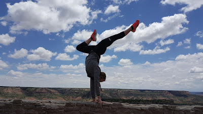
cool places to venture to and to unwind/relax. Today, we visited the Palo Duro
Canyon State Park, just outside of the small community of Canyon Texas, which
was where we were staying. The canyon has been dubbed “The Grand Canyon of
Texas”, and is the second largest canyon in the entire US! Before heading into
the canyon, we all went to Wal-Mart to stock up on picnic supplies and then
headed towards the canyon where we picnicked at the bottom and enjoyed some of
the hiking trails that were close by. Overall, it was a fun day, with more
exciting adventures to come of course!
Enjoy a selection of photos from the canyon taken by Delaney Sherwood, Visaya Phattaphone, and Gabe Szerlong.


Tuesday, May 23, 2017
Day 6 - Chase 2017
Day 6 (5/22/17): Odessa, Texas to Canyon, Texas (537 miles, 2788 total for the trip)
At our morning briefing we decided to head to the southeastern part of New Mexico for today's chase; in particular, we picked a target city of Carlsbad, New Mexico. When we arrived in Carlsbad we had lunch and then headed north of town towards Artesia. We found a nice area on a high ridge and sat and watched clouds continually try to develop but to no prevail. We stayed in that location for a 2-3 hours before heading back into town for a bathroom and snack stop. While making that quick stop a couple of clouds started to look more promising south of Artesia and heading to the southeast towards the east side of Carlsbad. We decided to position ourselves east of Carlsbad to watch the developing storms. We once again found a high ridge and had a good view of three cells. We were able to watch the evolution of these cells as they cycled through their evolution and ended up merging. While watching we were able to see a wall cloud, cloud-to-ground-lightning, and some precipitation cores. Also at the high ridge, scud clouds were visible. This is the area of the cloud where updraft occurs.
As the lightning and one of the precipitation cores (with some hail) got closer we repositioned to a new location to allow the storm to pass. It was worth the wait and getting wet from the rain because on the backside of the storm we were treated to the setting sun illuminating some mammatus clouds and a double rainbow. As we drove to our final destination we were also treated to a very picturesque sky with the dissipating storms being illuminated by the setting sun. Light blue areas within the clouds were also visible. The light blue color often indicates a hail core is present in the clouds.
Enjoy the pictures!!
 |
| Watching storms east of Carlsbad, New Mexico. Photo by John Frye |
 |
| Cloud-to-ground lightning strike. Photo by Luke Beringer |
 |
| Another cloud-to-ground strike. Photo by Andrew Eagon |
 |
| Another CG! Photo by Luke Beringer |
 |
| Mammatus clouds on the back side of the storms we saw. Photo by John Frye |
 |
| Catching the rainbow as the sun sets. Photo by John Frye |
 |
| A painted sky while driving to our destination for the evening. Photo by Luke Beringer. |
 | |||
| Gotta pass the time some how.... Photo by Nathan Hitchens |
Sunday, May 21, 2017
Day 5 - Chase 2017
Day 5 (5/21/17): Del Rio, Texas to Odesssa, Texas (286 miles; 2251 total for the trip)
The team got up early again for an 8:30 am weather briefing
for the developing systems within the area. Unfortunately, conditions did not
look favorable for chasing. There was a slight risk of severe weather occurring
throughout southwestern Texas. The slight risk for severe weather was
largely due to the high probability of straight-line winds and hail occurrence. Having to travel further
south for anything organized, we agreed
that it would be best to better prepare ourselves for tomorrow’s chase and take the scenic route
to see the beautiful nature of the Texas desert between Del Rio and Fort Stockton.
We left our
hotel around 10 AM and took the scenic route called
the Texas Pecos Heritage Trail. For the first leg of the trip, the road was
near the Mexican border. We stopped in Comstock to see the confluence of the Pecos River and Rio Grande River, it
started raining and we headed out. Our next scenic stop was in Langtry. On our
way to Langtry, we were hit by a heavy storm that had lightning right above us.
It finally lightened up and we made it to the Judge Roy Bean Museum that had
interesting history to learn. We continued on to Fort
Stockton and had lunch at K-BOBS Steakhouse. After lunch, we made
our way to the last stop for the day in Odessa, Texas. Although we did
not get to chase today, we were able to really take in the history and nature
around us.
 |
| Panoramic shot from the overlook near Comstock, Texas. The river in the foreground is the Pecos River and off to the left is where it empties into the Rio Grande River and Mexico. (Photo by Shelby Kelter) |
 |
| Luke Beringer ponders the meaning of life while enjoying the view at the overlook. (Photo by Shelby Kelter) |
 |
| Some of the artifacts at the Judge Roy Bean Museum. (Photo by David Kolodziejski) |
 |
| The bridge along US 90 over the Pecos River; some of the team members were not to thrilled about having to go over it. (Photo by Gabe Szerlong) |
Saturday, May 20, 2017
Day 4 - Chase 2017
Day 4 (5/20/17): San Angelo, Texas to Del Rio, Texas (287 miles; 1965 total for trip)
Our crew got up early today for our 8:30am
briefing in San Angelo, Texas. We left our hotel at 9:45am, and headed to our
target city of Uvalde, Texas. Three hours later we arrived, but after lunch came to
the consensus that nothing was looking to promising. We did drive north of Uvalde to view a storm that had a good reflectivity core on radar. We watched that storm and other clouds trying to get organized for about an hour until deciding
to leave for Del Rio, Texas, our stopping point for the night, at 3:30pm. Along the way, we took a quick pit stop at a
historical marker, and took in some of the neat nature that southwestern Texas has to offer. We are currently in Del Rio
(only a couple miles from the Mexican border) and had some delicious Mexican cuisine for dinner.
 |
| Dr. Frye showing the morning storms that were occurring to our south (photo by Andrew Eagon) |
 |
| Texas Hill Country (Photo by Andrew Eagon) |
 |
| Dr. Frye snapping a picture of nature (photo by Andrew Eagon) |
 |
| Luke Beringer, our resident fisherman, trying to use discarded line and lure to get a fish. |
 |
| Who wore it better; VP and his cacti shirt or nature? |
Friday, May 19, 2017
Day 3 - Chase 2017
Day 3 (5/19/17): Woodward, Oklahoma to San Angelo, Texas (492 miles; 1678 total for trip)
This morning, SPC forecast showed an enhanced risked of
severe storms in Oklahoma and Texas. At the forecast briefing, it was suggested
that there would be severe storm activity near Wichita Falls, TX. The group
left the hotel in Woodward, OK around 10 AM. Within in hour, we entered
Texas; which was a first for a couple of the group members. After a quick lunch break and checking on
storm development in Childress, Texas it was decided to head southeast toward central Texas in
order to chase storms that were starting there. We stopped at Putoff Canyon around 5 pm and observed a storm continually recycle itself near Jayton, Texas. It was
here we observe a beautiful landscape as well as growing anvil clouds in the
area. Once this storm began to die off we headed further south to try to intercept some storms developing near Sweetwater, Texas.
These storms died off as well before we arrived and so, we made our way to our destination of San Angelo, Texas in order to set us up for chasing tomorrow. While we were
heading there, more storms were ongoing well southeast of San Angelo and we were able to see a lot of lightning from the backside of the storm. We enjoyed a wonderful dinner together before checking into our hotel. We will be up and at it again tomorrow morning.
Thursday, May 18, 2017
Day 1 and 2 - Chase 2017
Day 1 (5/17/17): Whitewater, Wisconsin to Hays, Kansas (800 miles)
We rolled out of Whitewater around 9 am Wednesday morning to start the 2017 field course trip. After 14 hours we arrived in Hays, Kansas around 11 pm. When driving through Des Moines, Iowa we did encounter a poorly formed wall cloud. We kept our eye on this storm before moving on to the southwest. We wanted to get as far west as possible on this day to set ourselves up for Thursday's chase.
Day 2 (5/18/17): Hays, Kansas to Woodward, Oklahoma (386 miles; 1186 total for the trip)
Do to our drive late into the night Wednesday we held our briefing later in the morning. The mood of the group was good after the briefing and seeing the high risk that the SPC had issued for the day. We decided we would head south towards Dodge City, Kansas to have lunch and reevaluate the conditions. After our lunch stop we decided to move a little more south down to the extreme northern part of Oklahoma. We had some cells to our south in Oklahoma that at first looked promising but they quickly merged into a large cluster of storms instead of the isolated ones we would like to chase. We decided to drive back a little north back into Kansas as we had a visible cue field (area of cumulus clouds) developing in that area and there was a east-west oriented boundary (identified on radar) dropping south towards that cue field.
When we arrived in Minneola, Kansas a couple of new cells were quickly developing. Given the amount of shear that was being analyzed we figured these storms were promising. We moved a little east of Minneola to get a better viewing angle as the new cells started to merge. While moving south, one of the students (Amber) looked back and saw a decent sized funnel descending from the storm. By the time we pulled over to a safe spot to watch, that funnel had dissipated but a new funnel started to appear from a different portion of the storm. A third funnel cloud was then spotted back towards the location where the priginal one formed. With all of these, we could not verify if there was circulation on the ground or not from our vantage point. At this point the areas that had the circulation and funnel clouds were getting wrapped in rain. We decided to reposition ourselves back towards Minneola, on the drive back we spotted yet another area of circulation and another funnel cloud. Due to the tremendous amount of rain associated with these storms it was hard to verify if any of the funnel clouds reached the ground or not.
We decided at that point to start moving east and south towards our stopping point for the night, Woodward, Oklahoma. It was a very exciting day for us. Here are some pictures from the day.
 |
| Developing Cumulus clouds from the storms in Oklahoma that quickly merged into a big cluster of storms. Photo by Luke Beringer. |
 |
| One of the 4 funnel clouds we spotted today near Minneola, Kansas. Photo by Dr. Nathan Hitchens. |
 |
| One of the updraft portion of the storms near Minneola. Photo by Megan Matheus |
Subscribe to:
Posts (Atom)